Saturday, 2012-04-28
Good morning!
I woke up after 8:00am and already had a head-ache. I think I slept head-down on a slight angle without realizing it. The wine might have contributed, too. Breakfast was eggs with leftovers from last night: steak, potatoes, and squash.; very good.
 |
| Breakfast up! |
 |
| Morning light. |
 |
| Now you see 'em... |
 |
| ...Now you don't. |
 |
| Re-packing my pack. Trying to stick to the "essentials" on this hike. |
 |
| Packed up and ready to roll. Rendezvous at Ansel Adams Gallery this afternoon. |
Gone Hikin'!
Once the car was packed up, S.- went in search of some photographic scenery and some writing time, while I engaged in my "training hike" up the Mist Trail to the top of Vernal Falls, then onward to the John Muir Trail, and back down to the bus-stop for a ride to the gallery.
 |
| Launch point: Needed some open sky to start my Garmin. |
 |
| Looks like I am on the right path. |
 |
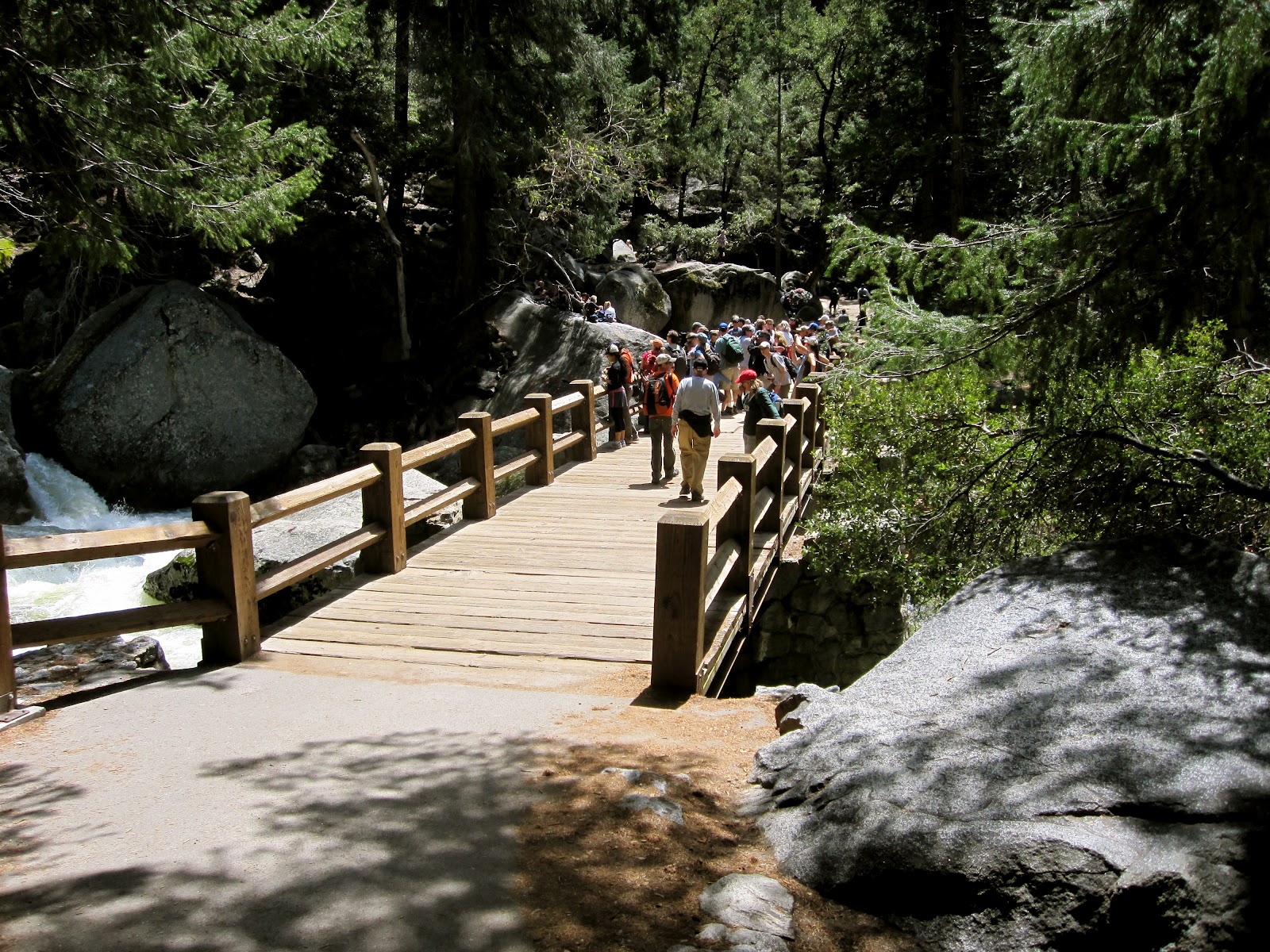
| Vernal Falls Footbridge, we meet again. |
If you have walked this trail before you know how steep it is. I had to stop a couple of times to catch my breath before I got to the bridge, then decided to take an extended break here and top off my Camelbak water bladder, eat some fruit, then press on.
 |
| It's just not a rest-break without a photo-op. |
 |
| The intrepid adventurer takes a break. Sepia tone is cool. |
 |
| The Mist Trail, actually misty today. |
 |
| My boots are taking in the scenery. |
Actually, the boots, my trekking poles, and I were waiting for the traffic-jam to clear a bit. I purchased a set of Leki curved rubber caps for my 'poles, and they worked far better than the rounded ones that were included with the poles. Last year, I left the original rubber caps on, and over the course of hiking up to the base of the Quarter Dome, and back down the JMT, I had completely worn through the base of the caps.
 |
| That's the traffic jam up the trail: Lots of people hiking up, and stumbling down. |
 |
| View of Vernal Falls (middle), and Nevada Falls (top) from Glacier Point. Courtesy of S.- |
 |
| The mist is in the air... |
 |
| Standing water on the trail (in many places). |
 |
| Woo-Hoo! I made it to the top, again. This time it was all self-motivation. |
Once I had rested up for something like (40)min. (ate something, napped a little, tried to decide if I
really was going to barf this time from the exertion) I moved on up the trail. I had to find the linking trail from the top of Vernal to the John Muir Trail, which I already knew was above me and to the south of the Nevada Falls. I just wasn't sure where the path was, since we had bypassed that section on the hike last year, and it did not seem to be obviously marked.
Once I found an upward-running trail, I followed it. Several people I asked did not know if it connected to the JMT, or where it went, so I trusted my direction of travel to get me there anyway. A couple of people even asked me, and I told them I was not sure, but believed that it would get us there; they gave up in frustration after a few upward switchbacks.
 |
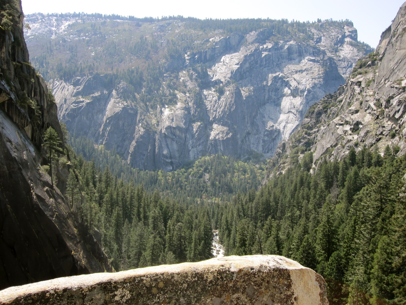
| Looking back down into the valley. The Merced River is in the middle. |
 |
| Vista point! Vernal Falls from the linking trail up to the JMT. |
 |
| Nevada Falls from the link-up point with the JMT. (Clark Point, elev. 5400 ft.?) |
 |
| USGS Marker: "U.S. Geological Survey B.M. 250 Dollars Fine for Disturbing this Mark, 10-18-1905." |
 |
| Signage at the intersection. Signage (c) The Yosemite Fund? |
 |
| Onward...HO-O-O-O!! |
 |
| Shiny! |
 |
| Um... Is this the road to Mirkwood Forest? |
 |
| A lonely patch of snow hiding out in the curve of the trail. (It's shady in the morning...) |
 |
| I'm close to the river again! The footbridge must be close now. |
 |
| Back across the bridge and into the final stretch. |
 |
| Illilouette Fall across the valley. The clouds are covering the valley again. |
 |
| Back at the trail sign!! The end is near. |
 |
| On the bus! Time: 1810-hrs. (6:10PM). Only (70)min. overdue for rendezvous with S.-. *sigh* |
 |
| Through the trees: Upper Yosemite Falls. Only minutes more to the Ansel Adams Gallery. |
I finally got back down to the bus stop (Stop #16-Happy Isles on the bus loop map) at about 1800 hrs. (6:00PM), an hour late for the secondary rendezvous time. D'oh! I arrived at the Ansel Adams Gallery and S.- was still patiently waiting on a bench across from the gallery, reading a book. I sat down for a couple of minutes, apologized, and recapped my adventure hike, then we advanced back to the car to leave the park.
At this time we were both cold, tired and hungry, and Clif Bars did not sound appealing. Once we were out of the park we proceeded immediately to
The Happy Burger Diner in Mariposa. I nodded off at some point during the drive, but S.- was at the wheel and we arrived promptly after dark. Our meals were very satisfying, and I even had a cup of coffee to try and stay awake for the rest of the trip back to Merced. I still nodded off a little near Merced. Tired as I was, I actually remained awake the entire drive back to Modesto. Boy was I tired.
What a great weekend!
Perspective:
Time to Vernal Falls Footbridge: (1.00)hr.
Rest-time at Footbridge: (44)min.
Time to top of Vernal Falls: (58)min.
Rest-time at top of Vernal: (41)min.
Time back to the footbridge via JMT: (1:33+)hrs.
[Garmin battery died before I hit the bridge again.]
Total Recoded Time, Trail Head Parking Lot to Garmin Died Point: (5:00:03.96)hrs.
Actual total trail time: (6:00+)hrs.
-Lancer!!


No comments:
Post a Comment